
TRG Info and Advice

Tokyo Bridges
A Brief History of Bridges in Tokyo
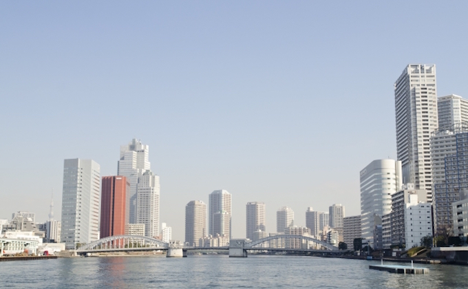
Many rivers and waterways run through downtown Tokyo, and over 500 characteristic bridges span the flows.
Bridges are reflections of the era in which they were built.

During the Edo Period (1603-1867), the shogunate did not actively promote bridge construction due to defense reasons and conflicts of interest, therefore, only five bridges stretched across the River Sumida. Ferry services played an important role in providing crossings over to the other banks, and around 1907, there were 18 ferry points along the river, as many as there are bridges today. The oldest of them was Hashiba no Watashi (“crossing at Hashiba”), which was located near the current Shirahigebashi Bridge. The surrounding area of northern Asakusa was already the focal point of both water and land ways in the Heian Period (794-1185). Those ferry crossing services came to an end in 1964, however, when the last service of Tsukuda no Watashi (“crossing at Tsukuda”) stopped its operation.
From the Meiji Period to the early Taisho Period (early 19th century), Tokyo was transforming from “castle town” to “capital city of a modern nation,” so that it would not be deemed uncivilized and overlooked by the Great Powers of the West. Until the Taisho Period, most of the bridges in Tokyo were made of wood. City life may have appeared modernized on the surface, but the infrastructure remained that of a castle town. The entire nation was committed to developing industries, and the population began flocking to the capital. Then, the Great Kanto Earthquake hit the city, and the former castle town was destroyed. Recovery from this disaster was a major project, not only to rebuild after the Earthquake, but to complete the transformation of Edo into the modern city of Tokyo. During reconstruction, the six major bridges spanning the Sumida River were built in different styles, using the latest materials and techniques of that time.
While motorways and railways are the main means of transport today, waterways played a central role in the past. Bridges were something to both go over and under. When traveling by boat along a river, passage under one bridge after another is a given. Bridges built in the Imperial Capital Recovery Project, therefore, were designed with those who would “pass under” in mind, and convenience for waterway users was, also, taken into consideration.
As time passed, great importance gradually came to be placed on efficiency, and standardized designs were valued the most. Because of the rubble of bombed-out, burnt buildings and houses after World War II, plus the rapid development of motorized transportation, many waterways were filled in, and bridges such as Kyobashi, Sukiyabashi and Gofukubashi disappeared, leaving only their names to mark the spot. Not just the bridges, but Tokyo’s entire landscape is a result of planning and decisions made by those who experienced the devastation of both earthquake and war.
Most of us go over a bridge without paying much attention to it. However, bridges shape the view you see, and the landscape, in turn, is characterized by the bridges.
Visit Tokyo’s bridges for a different view, and one that can illustrate the course of Tokyo’s history.
The River Nihombashi
Nihombashi Bridge: Nihombashi–Nihombashi Muromachi, Chuo-ku
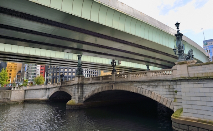
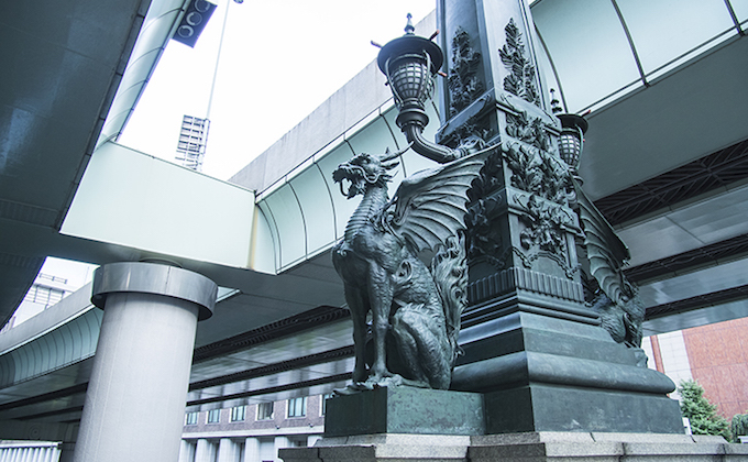
The name, Nihombashi, stands for the bridge, the river it crosses, and the surrounding area. It served as the starting point for the Edo Five Routes including Tokaido. Nihombashi still serves as the starting point of roads in Japan, and you can find the “Road Origin Marker” relief at the center of the bridge. It is not clear exactly when the bridge was built, but it is reputed to have been there by 1603. Since it was built at a time when many boats were going back and forth beneath it, the abutment on the stone walls was tall, and the bridge was arch-shaped. At the center of downtown Tokyo, the Nihombashi area was full of activity. The current Nihombashi Bridge is a stone-bridge built in 1911, featuring elaborate decorations. A total of thirty two statues are placed on the bridge, including statues of a lion holding the city crest of Tokyo at the edges, and statues of kirin (an auspicious mythical creature) located along the midway. Twenty-eight statues can be seen from the bridge, but the rest can only be seen from the river.
Tokiwabashi Bridge: Otemachi, Chiyoda-ku-Nihombashi Hongokucho
One of oldest bridges in Tokyo, Tokiwabashi Bridge is said to have been first built in 1590. It was originally a wooden bridge but was eventually replaced by a stone bridge. The current bridge is the only one still in existence, from among over ten double arch stone bridges built at the time of Civilization and Enlightenment in the Meiji Period. The bridge stands at the place where Tokiwabashi Gate of Edo Castle was located, and it was built by masons from Nagasaki using stones that used to form the walls at the square-shaped entrance space built for defense purposes (masugata). (Some parts of the masugata at Tokiwabashi Gate, designated a national historic site, can still be seen.) The bridge features a Japanese-style design reminiscent of the castle gate, such as newel posts like stone lanterns and stone abutments. It has two tracks for pedestrians and cars, but only pedestrians are allowed onto the bridge. The bridge was, however, damaged by the Great East Japan Earthquake of 2011, and it is currently undergoing both dismantlement and rebuilding (scheduled to be completed in March, 2018).
Toyomibashi Bridge: Shinkawa 1-chome, Chuo-ku-Nihombashi Hakozaki
Toyomibashi Bridge is a Vierendeel through-bridge that looks like a horizontal ladder, and is designated as a tangible cultural property in Chuo-ku, Tokyo. It stands at the confluence of the Rivers Nihombashi and Sumida. Built in 1698, the bridge used to be called Otomebashi Bridge. The neighborhood used to be called Shinborikashi, which was a loading point of sake delivered by merchant freight ships from around Japan, and riverbanks were lined with white-walled sake warehouses. Toyomibashi Bridge was replaced by an iron bridge in the Meiji Period, but burnt down in the Great Kanto Earthquake. The current bridge was built in 1927 during the recovery project. The first bridges spanning the rivers which flow into the River Sumida were designed so they could be distinguished from a distance and the rivers could be easily identified. There are only a few bridges in the same style as this one.
The River Onagi
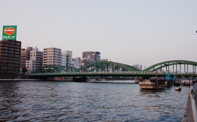
Mannenbashi Bridge: Tokiwa-Kiyosumi, Koto-ku
Mannenbashi Bridge is the first bridge over River Onagi at the confluence with River Sumida. In the Edo Period, a “funabansho” (barge/ship guard station) was located on the north side of the bridge, so the bridge was called “Motobansho-bashi” (ex-guard station-bridge). The bridge was known as a great spot for viewing Mount Fuji over the River Sumida. A tied-arch bridge, the current bridge, was completed in 1930 and replaced in 1979. You can have the best view of Kiyosubashi Bridge from here.
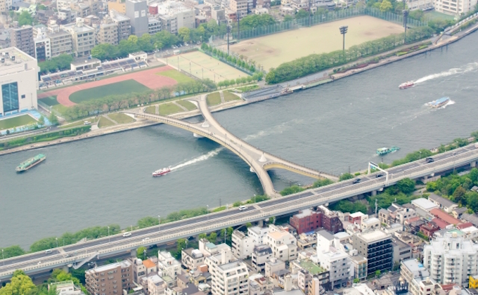
Onagigawa Clover Bridge: Oshima Icchome–Ogibashi Sanchome, Koto-ku
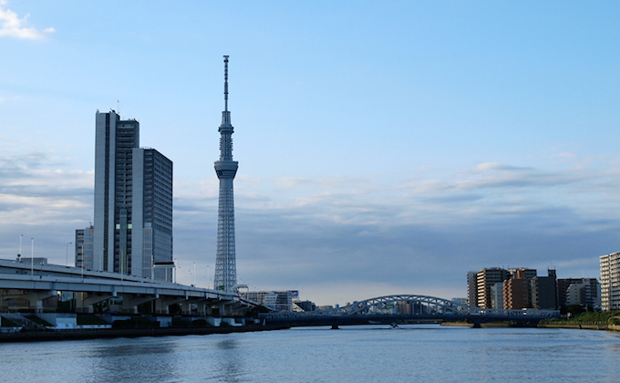
Erected at the confluence of the Rivers Onagi and Yokojikken, Onagigawa Clover Bridge is a unique, x-shaped pedestrian-cyclist bridge consisting of two crossed girders of four meters wide, and 80-meters and 60-meters long. Completed in 1994, this is the first bridge of its kind in Tokyo. From this bridge, you can enjoy a lovely view of Skytree.
The River Kanda
Hijiribashi Bridge: Kanda Surugadai Yonchome, Chiyoda-ku¬–Yushima Icchome, Bunkyo-ku

Hijiribashi Bridge was constructed during the recovery plan following the Great Kanto Earthquake. It took almost three years to complete this bridge, due to difficulties in building a bridge over the deep valley of the River Kanda. A distinctive arch bridge, the three-dimensional beauty of the pillars was a new attraction in Tokyo at that time. Chosen from suggestions by the public, it was named Hijiribashi Bridge (sacred bridge) after its location, which bridges the two sacred locations of Yushima Seido (a Confucian temple designated as a national historic site) on the north, and Holy Resurrection Cathedral (a.k.a. Nikorai-do), a designated national important cultural property, on the south. It is a steel and concrete bridge measuring 92-meters long and 22-meters wide.
Yanagibashi Bridge: Yanagibashi Icchome–Yagagibashi Nichome, Taito-ku
Because the bridge was built at the junction of the Rivers Kanda and Sumida, it was first called Kawaguchi Deguchi no Hashi (a bridge at the estuary and mouth of a river). A shogunate’s warehouse of arrows was located nearby, and the bridge was also called Yanokurabashi (arrow storehouse-bridge) or Yanoshirobashi (arrow castle-bridge). Yanagibashi Bridge is believed to have been built for the first time in 1698. It was renovated into a steel bridge in 1895, and the current Lohse Bridge was completed in 1929, modeled after Eitaibashi Bridge. In the Edo Period, the area surrounding the bridge flourished with ferry operators, and it was a red-light district. During the repairing works in 1991–92, reliefs featuring geisha hair ornaments were placed and the walkway was covered with granite stone, to produce a more atmospheric feeling. The area beneath the bridge still serves as a ferry point, and many boats are moored there in the evenings. There are also yakatabune points, where you can board.
The River Sumida
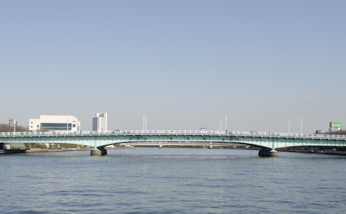
Senju Ohashi Bridge: Minamisenju Rokuchome, Arakawa-ku–Senju Hashido-cho, Adachi-ku
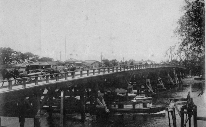
Senju Ohashi is the first bridge built by the first shogun Ieyasu Tokugawa after he entered Edo in 1594. It was also the first bridge erected over the River Sumida. At first, it was simply called Ohashi (big bridge), but after the Ryogokubashi Bridge was built in 1659, Ohashi came to be called Senju Ohashi. The Ohashi in the Edo Period was a wooden bridge, measuring 120-meters long and 7-meters wide. This bridge was a focal point on the routes of Oshu, Nikko and Mito, connecting the northern and southern post towns of Senju. It was also the only big bridge crossed by processions of representatives from over thirty districts in the Tohoku Region, on their mandatory trips to Edo every other year. The current bridge is a braced-rib arch bridge made of steel, which was replaced during the Great Kanto Earthquake Recovery Project. Due to increased traffic volume, another bridge, exclusively for inbound traffic, was built right next to the bridge on the downstream side, and the road was separated into inbound and outbound lanes.
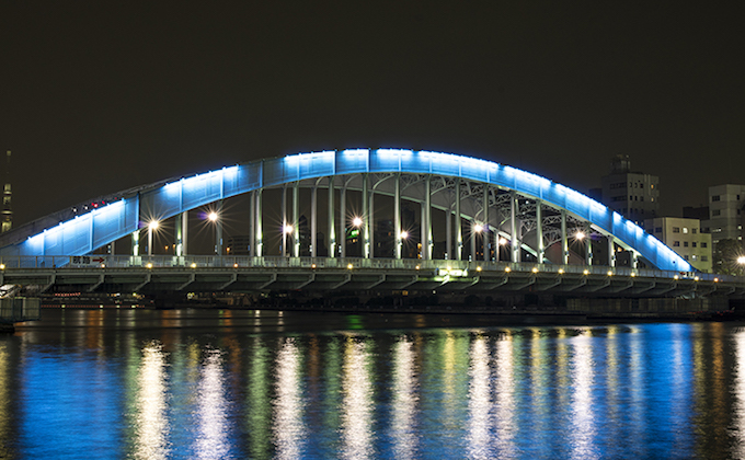
Shirahigebashi Bridge: Hashiba Nichome, Taito-ku–Tsutsumi-dori Nichome, Sumida-ku
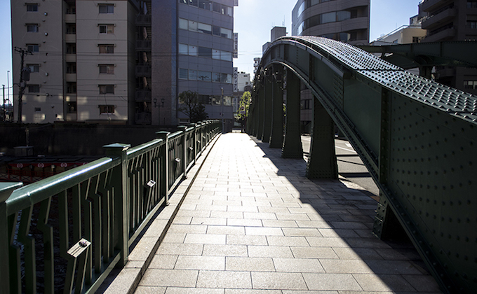
A stoutly steel bridge with an elegant, well-rounded arch, Shirahigebashi Bridge appears as massive as Eitaibashi Bridge. The first Shirahigebashi Bridge was a tool bridge built using wood in 1914. It was funded and managed by neighbors, and later managed by the Tokyo municipality. The current one is a steel-made, three-span, tied-arch bridge. Only the central span is arched, with the spans on the sides coming into a truss design that is connected gently to the arch. Until the bridge was completed, the Hashiba no Watashi ferry crossings, which can be traced back to the Heian Period, were in service and many people went from one side of the river to the other by ferry.
Sakurabashi Bridge: Mukojima Nichome, Sumida-ku¬¬–Imado Icchome, Taito-ku
Sakurabashi Bridge is the only pedestrian bridge that spans the River Sumida, linking Sumida City and Taito City. The x-shaped bridge was designed in the hope of having people from four points on both sides, upstream and downstream on either side, have an encounter midway. You can enjoy a view of the River Sumida and cherry blossoms on both sides of the riverbank in spring.
Kototoibashi Bridge: Asakusa Rokuchome¬, Taito-ku–Mukojima Icchome, Sumida-ku
There were two ferry crossings, Takeya no Watashi and Yama no Yado no Watashi, around the area. Kototoibashi Bridge was first built between the two, in the Great Kanto Earthquake Recovery Project. One of the three major Gerber bridges along with Ryogokubashi Bridge and Temmabashi Bridge (Osaka), Kototoibashi Bridge is a long and grand bridge featuring a simple, linear style, and strong design. Built with views and the landscape in mind, the bridge was designed to have lower handrails than usual and fewer pillars. During the Great Tokyo Air Raids by US bombers, on the 10th of March in 1945, so many people fled to the bridge from both sides of the river that it became packed with people, luggage, and carts, and they ended up stuck on the bridge. Resulting fires from the air raids trapped people on the bridge, and thousands are said to have died there. The newel post of Kototoibashi Bridge is preserved as is, in remembrance of the tragedy. Remains of the handrails and kerbstone of the bridge can also be seen at the back of Edo-Tokyo Museum in Ryogoku.
Azumabashi Bridge: Hanakawato Icchome, Taito-ku¬–Azumabashi Icchome, Sumida-ku
On the route of Kaminarimon Street, Azumabashi Bridge is the last bridge built over the River Sumida during the Edo Period in 1774. Until then, ferries were used to cross from the points (now) under the bridge called Takecho no Watashi. This bridge is said to have been built through funding by locals, after six townspeople on the Asakusa side petitioned the Shogunate for construction. Azumabashi was originally called Okawabashi (literally: big river bridge), but when it was replaced in 1876, it was renamed Azumabashi. After several reforms (from wood to iron), the current, steel bridge was completed in 1931, and features triple arches under the floor. Designated as a Tokyo Historical Building.
Komagatabashi Bridge: Kaminarimon Nichome, Taito-ku–Higashikomagata Icchome, Sumida-ku
Completed in 1927, Komagatabashi was built as part of the recovery plan after the Great Kanto Earthquake. Until then, ferry crossings called Komagata no Watashi were common. Suggestions were invited from the public, and the bridge was named after Komagatado Hall (a Buddhist temple with a blue roof). Painted in blue reminiscent of the Komagatado roof, Komagatabashi is a half-through and deck, solid-rib arch bridge. There are stone balconies in the middle of the bridge that serve as viewing decks.
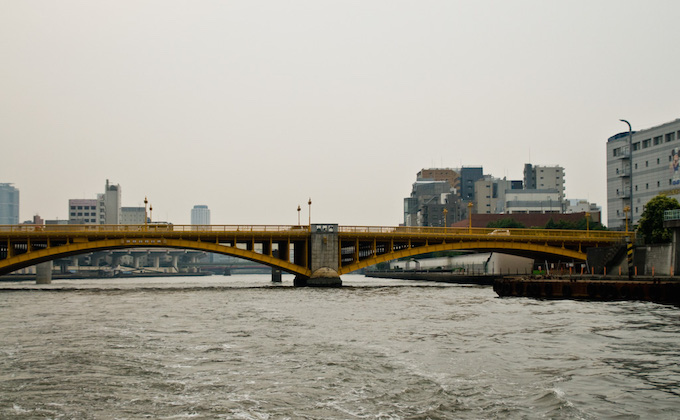
Umayabashi Bridge: Kuramae Nichome, Taito-ku–Honjo Icchome, Sumida-ku
The current Umayabashi (literally: stable bridge) was built in 1929, featuring elegant triple arches. The floor has zig-zag gaps between the arches, so their expansion and contraction can be adjusted in summer and winter. In the Edo Period, there used to be stables for horses around this area, and that is the origin of the bridge’s name. Pillars at the ends have stained-glass lights with illustrations of horses on them.
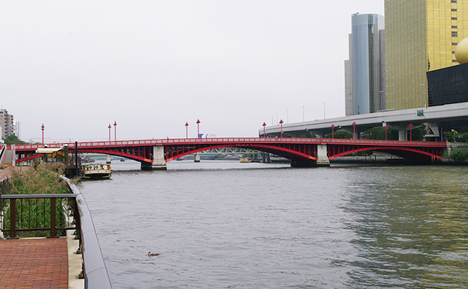
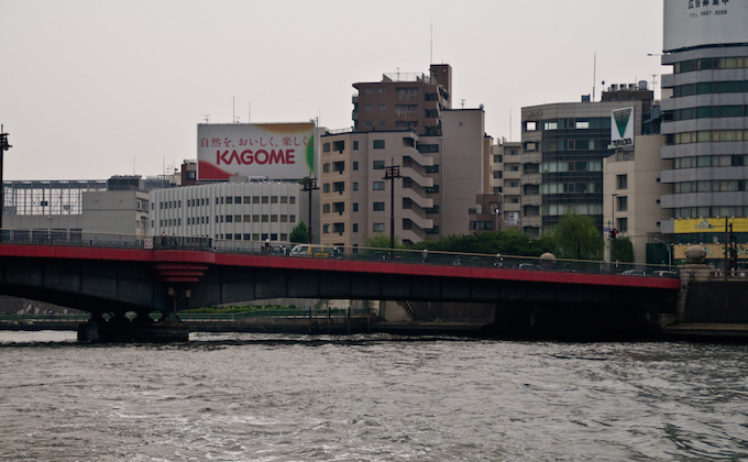
Kuramae Bridge: Kuramae Nichome, Taito-ku–Yokozuna Nichome, Sumida-ku
Replaced after the Kanto Great Earthquake, Kuramae Bridge attracted people’s attention because of the avant-garde status of its arch structure at the time. The name is derived from the history of the place, where dozens of shogunate-owned rice kura (storehouses) were lined up in the Edo Period, and that is why the terrace on one side is maintained, to provide the image of the row of storehouses.
A ferry crossing of Fujimi no Watashi came to an end when this bridge was built, but openworks, which hold the bridge name plaque, illustrate the ferry crossing. Because Kokugikan (sumo hall) stands on the East side of the bridge, the handrails are decorated with sumo-themed openworks. Measuring 173-meters long and 25-meters wide, Kuramae Bridge is painted in yellow, to evoke the image of rice husks.
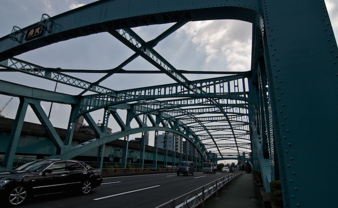
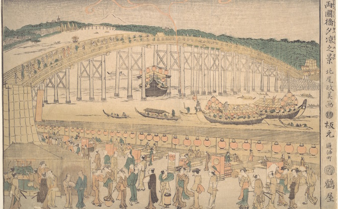
Ryogokubashi Bridge: Higashi Nihombashi, Chuo-ku–Ryogoku, Sumida-ku
The first Ryogokubashi was built a little bit downstream compared to the current location. It was originally called “Ohashi” (big bridge), and also “Nishubashi” (two districts bridge), because the River Sumida defined the border between the Musashi and Shimofusa districts. Later, it was renamed “Ryogoku Bridge” (both districts bridge), because it links the two districts. Avenues to prevent fire were provided on both sides of the bridge, and they became the most vibrant spot in the town of Edo, crowded with people. The river season officially opened on the 28th of May, and during the summer’s “enjoy-the-cool-evening-breeze” period until the 28th of August, fireworks were launched, fascinating the Edo people.
The current bridge, measuring 165-meters long and 24-meters wide, is a Gerber bridge with steel plate girders, completed in 1932. It features pillars with unique, ball-shaped lights on top, and sumo-inspired designs, such as round-shaped bays modeled after the sumo ring, and handrails between motorways and walkways with openworks of a sumo referee’s fan. Ryogokubashi was designated a Tokyo Historical Building in 2008.
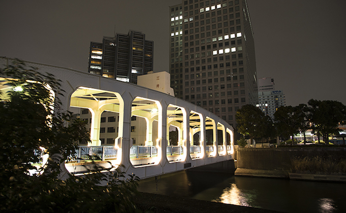
Kiyosubashi Bridge: Nihombashi Nakasu, Chuo-ku–Kiyosumi, Koto-ku

Designated a National Important Cultural Property, Kiyosubashi was modeled after the beautiful Deutz Suspension Bridge in Cologne, Germany. Kiyosubashi was built in 1928 as one of the Imperial capital recovery projects after the Kanto Great Earthquake, along with Eitaibashi Bridge. Measuring 186.2-meters long and 25.9-meters wide, Kiyosubashi Bridge is a self-anchored, stiffened suspension bridge with three spans. Abutments are built into the reinforced concrete construction, and the superstructure connects the slings, suspended from towers, and the main girder with suspenders. Kiyosumibashi was built by making maximum use of cutting-edge materials and techniques for structure and construction methods, and that makes this bridge a distinguished example of the suspension bridges built in the early Showa period.
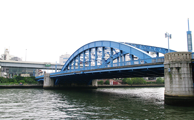
Eitaibashi Bridge: Nihombashi Hakozaki, Chuo-ku–Saga, Koto-ku
Measuring 185.2-meters long and 22-meters wide, Eitaibashi is a popular, blue-colored, well-structured arch bridge made of steel.
Eitaibashi Bridge was originally located about 100 meters upstream from its current location. Measuring 200-meters long, it was a huge wooden bridge with a clear headway of at least three meters under its girders, even at the time of the spring tide, so that boats could navigate beneath the bridge. It is said that great views as distant as Mt. Fuji, Mt. Tsukuba, and the Izu area could be enjoyed from the top of the bridge. Until the bridge was first built in 1696 or 1698, ferries provided crossings (Fukagawa no Owatashi). The name Eitaibashi is derived from the island name of Eitaijima on the left side of the bridge. The bridge was relocated to the current location in 1897 and replaced with a steel truss bridge. However, it was burnt down in the Kanto Great Earthquake in 1923, as the floor system was still made of wood.
The bridge today was built in 1926 as one of the recovery projects after the Earthquake it features a huge, parabolic solid-rib arch with a sense of dignity. At the time, Eitaibashi was the first bridge on the mouth of the River Sumida. It was designed after the Ludendorff Bridge (sometimes referred to as the Bridge at Remagen) which spans the River Rhine, so it would well represent the “gate to the Imperial capital.”
Designated National Important Cultural Property.
Kachidokibashi Bridge: Tsukiji–Kachidoki, Chuo-ku
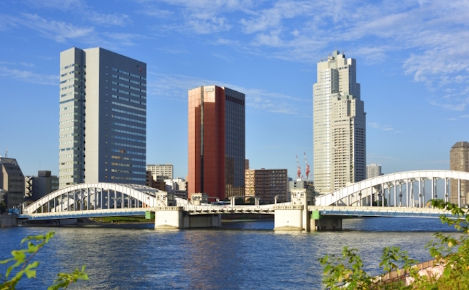
Designated as a National Important Cultural Property, Kachidokibashi is a lift bridge spanning the mouth of the River Sumida. Completed in 1940, this bridge has a unique structure designed for co-prosperity of marine and land transportation, and is valuable as the only Chicago-type, double-leaf, bascule in Japan. The two girders were constructed so that they would lift at the same angle and speed.
There was a plan to hold both the Olympics and the World Expo at the same time in 1940 to commemorate the twenty-sixth century since the foundation of the Empire of Japan. Planned as the main gate to the Expo venues, as well as the welcome gate for guests visiting by boat, Kachidokibashi was completed using the world’s most advanced technologies. Those events were, however, cancelled due to the deterioration of the Japan-Sino War situation, leaving just the completed bridge, all trussed up with no one to welcome.
Tokyo Trams used to run on the bridge, and rails were built with expansion parts so they would remain seamless at the center where girders lift.
Kachidokibashi Bridge stopped lifting in 1970 in order to ease traffic congestion as motor vehicles rapidly increased.
Other Bridges to Note
Hachimanbashi Bridge (former Danjobashi Bridge): Tomioka Icchome, Koto-ku
The first iron bridge built in Tokyo, Hachimanbashi used to span the River Kaede in the Kyobashi area in Tokyo (today Chuo-ku, Tokyo). It was transferred to where it stands today, and is now called Hachimanbashi. It is a road bridge of 15.2 meters in length, featuring a tied arch with a single span. The arch is made of cast iron, but the other parts are made of wrought iron, so this is a rare combination of materials that cannot be seen today. Designated National Important Cultural Property.
Nagaike Mitsukebashi Bridge: Bessho 2, Hachioji-shi, Tokyo
Nagaike Mitsukebashi spans a pond situated in Nagaike Park in Hachioji. It is the former Yotsuya Mitsukebashi, which used to stand in Yotsuya, Shinjuku, popular in remembrance of the time of Civilization and Enlightenent during the Meiji Period. Completed in 1913, it is a steel, arch deck bridge. The beautiful decorations in the Neo-Baroque style were adapted to match the design of Akasaka Rikyu (the State Guest House today). It was initially planned to demolish and expand the bridge, but it was restored using some materials of the original design in 1993.
Hikawa Ohashi Bridge: Okutama-cho, Nishi Okutama-gun, Tokyo
Named one of the 100 great bridges by a bridge engineering expert, the current Hikawa Ohashi was completed in 1933. The arch spanning the river is made of concrete, and side spans on both sides are double-layered, rigid frames of concrete. The bridge surface is 30 meters above the river. Later, another arch bridge in the same design was built to expand the road and the deck slabs were integrated. If you go down the trail path by the bridge, you can see the two arches of the old and new bridges. Handrails hold panels featuring relief of the area’s typical plants and birds, such as Rhododendron dilatatum, wasabi, and the copper pheasant. In addition to this bridge, there are many suspension bridges in the valley of Okutama.
Other things to note
Ogibashi Lock: Sarue 1-5-18, Koto-ku
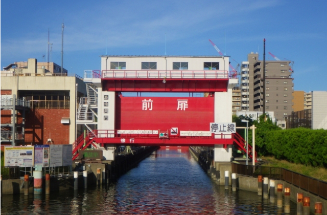
Located between Shin Ogibashi Bridge and Komatsubashi Bridge on the River Onagi, Ogibashi Lock is called “Tokyo’s mini Panama Canal.” It is currently closed until the 31st of Mach, 2019, due to seismic retrofitting work.
Arakawa Lock Gate: Komatsugawa Icchome, Edogawa-ku

Arakawa Lock links the Rivers Arakawa and Kyu-Nakagawa. It was impossible to navigate the two rivers because of the big gap in water levels (max. 3.1 meters), but the completion of this lock in 2007 finally connected the Rivers Arakawa, Kyu-Nakagawa, Onagi, and Sumida. It is hoped that this lock will play a vital role when motorways and railways are shuttered during times of disaster and provide a means of transport for goods, materials, and refugees through waterways.